| l2gen | |
Creates a Level 2 file from an input Level 1 (A or B) file.
Tools -> OCSSW Processing -> l2gen
For the command line version of help run l2gen -help
The l2gen GUI is dynamically created based on the selected IFILE. Once the IFILE is specified, l2gen is run in the background in a special mode in order to obtain and populate all the parameters and defaults for l2gen GUI. This means that if a new version of l2gen comes out, with new parameters, defaults, etc., your current version of SeaDAS will automatically support these parameters. Note that because of this l2gen dependency on the building of the GUI, SeaDAS 7 requires l2gen version 6.5.7 or later.
All l2gen parameters are contained within a series of categorized tabs:
Non-Defaults Selected Indicator (*)
When a parameter is chosen to be
a non-default value, that parameter will show up in the parfile textarea of the MAIN tab.
As an aid to help direct
the user to tabs containing at least one parameter set to a non-default value, an asterix
(*) will appear at the top
of the tab. Also within the tab, an asterix will appear next to each parameter which is a
non-default value.
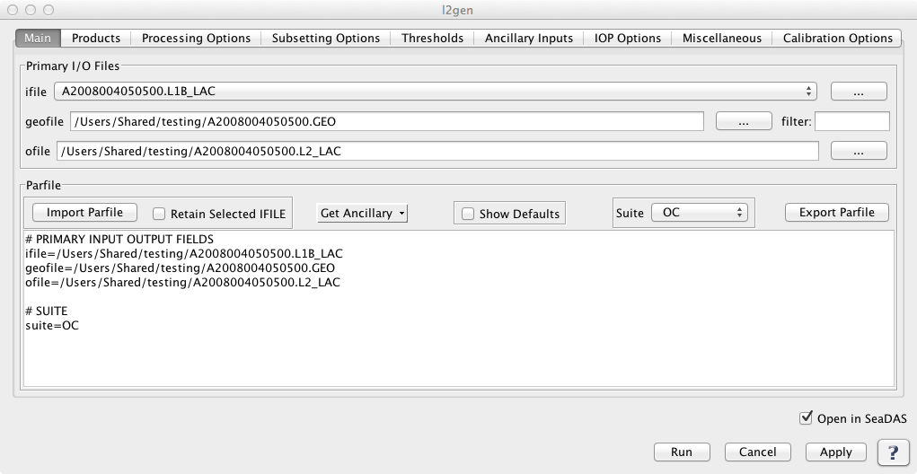
THE MAIN TAB |
|
Selecting the IFILE Once this IFILE has been specified, the mission and data level are obtained from this file. If the IFILE data level matches the expected input data level of l2gen, the GUI will then use this file to run l2gen in the background in order to obtain and populate all the parameters and defaults of l2gen GUI. One thing very important to note is that since this GUI is built from the IFILE, a subsequent selection of a different IFILE will cause the GUI to be rebuilt with all the fields set to the defaults. If you have parameters already specified and wish to save these, then the best route would be to save them in a parfile, select a new IFILE, then reload the parfile. An alternate way to try to keep your currently selected parameters, is to type the ifile name into the parfile textarea in the GUI.
Selecting the OFILE and the GEOFILE
Get Ancillary Files
Show Defaults
Suite
Parfile Textarea It's useful to note that when you are editing text in the parfile textarea you can click "Apply". This will cause the text to update all the GUI parameters. The parfile textarea will automatically be reformatted in a consistent way, so be aware that the order of your hand-entered parameters may change due to this. Clicking on another field or another tab will also have the same effect as clicking the "Apply" button. To reset all parameters within a given tab to the default, click the button at the bottom of the panel. To reset all parameters within all tabs, no button as of yet exists but you can simply delete the entire parfile textarea in the main tab, and this will restore everything to default. |
|
|
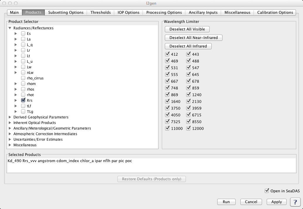
THE PRODUCTS TAB |
|
The l2gen product parameter L2PROD is initially set to the default value. At any time L2PROD can be restored to the default value by clicking 'Restore Defaults' at the bottom of this tab. L2PROD can be specified in a multitude of ways. Note that a change within any of one these product specifier controls will automatically update the others.
Product Selector
Wavelength Limiter Note that a change in the 'Wavelength Limiter' will not directly change the products selected, but only effects the behaviour of the 'Product Selector'. Also note that the Wavelength Limitor tool is expected to contain a list of wavelengths regardless of the mission selected. The wavelengths do vary depending on mission. If this tool does not contain any wavelengths then there is likely a problem and could perhaps be a bad IFILE.
Selected Products Textarea |
|
|
THE PROCESSING OPTIONS TAB |
|
|
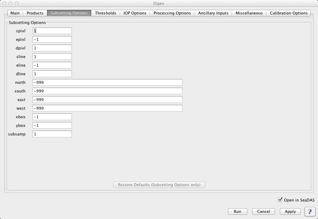
THE SUBSETTING OPTIONS TAB |
|
This contains 2 sets of mutually exclusive options: pixels (spixl, epixl, dpixl, sline, eline, dline) and coordinates (north, south, east, west). This GUI will not permit selection of both sets, resetting the prior selection to the default. (i.e. If you set pixel field to a non-default value and then subsequently set a coordinate field to a non-default value, the latest selection (the coordinate field) will take precedent and the previously set field (the pixel field) will be automatically reset to the default. |
|
|
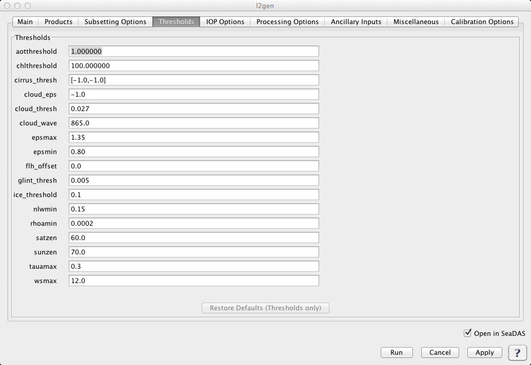
THE THRESHOLDS TAB |
|
|
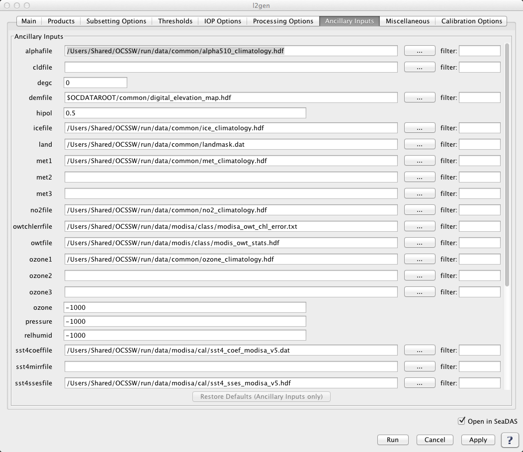
THE ANCILLARY INPUTS TAB |
|
|
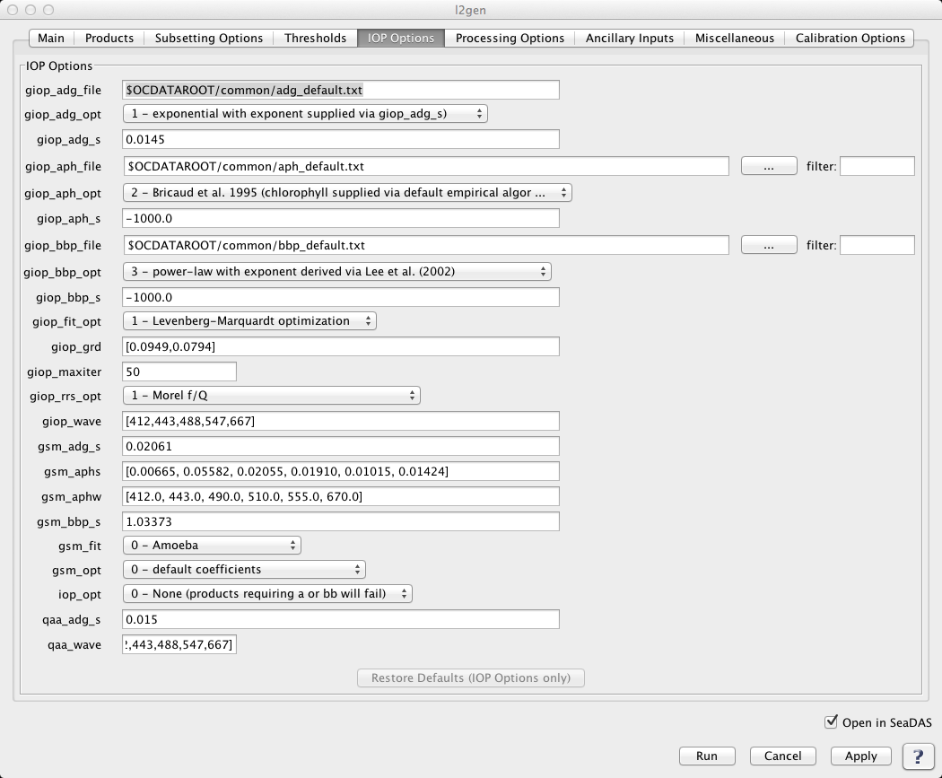
THE IOP OPTIONS TAB |
|
|
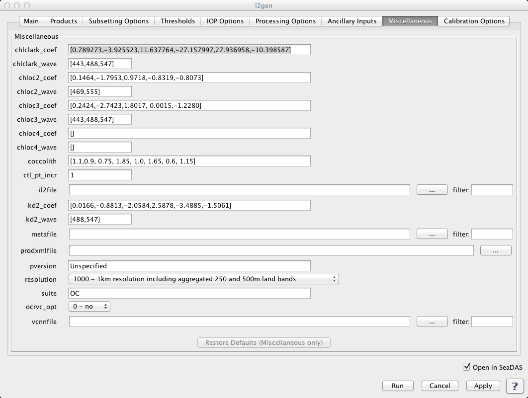
THE MISCELLANEOUS TAB |
|
|
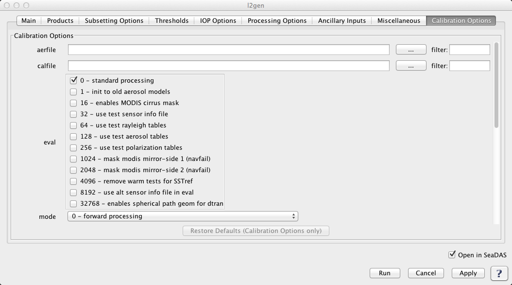
THE CALIBRATION OPTIONS TAB |
|
|
l2gen 6.5.6 (Nov 17 2011 13:42:08)
Usage: l2gen argument-list

  The argument-list is a set of keyword=value pairs. The arguments can
  be specified on the commandline, or put into a parameter file, or the
  two methods can be used together, with commandline over-riding.

The list of valid keywords follows:

   -help (bool) (alias=-h,--help) (default=false) = print usage information
   -version (bool) (alias=--version) (default=false) = print the version
        information
   -dump_options (bool) (alias=--dump_options) (default=false) = print
        information about each option
   -dump_options_paramfile (string) (alias=--dump_options_paramfile) = print
        information about each option to paramfile
   -dump_options_xmlfile (string) (alias=--dump_options_xmlfile) = print
        information about each option to XML file
   par (string) = input parameter file
   pversion (string) (default=Unspecified) = processing version string
   suite (string) (default=OC) = product suite string for loading
        suite-specific defaults
   eval (int) (default=0) = evaluation bitmask
          0: standard processing
          1: init to old aerosol models
         16: enables MODIS cirrus mask
         32: use test sensor info file
         64: use test rayleigh tables
        128: use test aerosol tables
        256: use test polarization tables
       1024: mask modis mirror-side 1 (navfail)
       2048: mask modis mirror-side 2 (navfail)
       4096: remove warm tests for SSTref
       8192: use alt sensor infor file in eval
      32768: enables spherical path geom for dtran
   ifile (string) (alias=ifile1) = input L1 file name
   ilist (string) = file containing list of input files, one per line
   geofile (string) = input L1 geolocation file name (MODIS only)
   ofile (string) (alias=ofile1) (default=output) = output L2 file #1 name, output vicarious L1B
        for inverse mode
   ofile[#] = additional output L2 file name
   il2file (string) (alias=il2file1) = input L2 file names for sensor to be
        used as a calibrator.  Alternatively, a data point can be used as a
        calibrator (e.g. MOBY)
   il2file[#] = additional L2 callibration file names
   tgtfile (string) = vicarious calibration target file
   aerfile (string) = aerosol model specification file
   metafile (string) = output meta-data file
   l2prod (string) (alias=l2prod1) = L2 products to be included in ofile #1
   l2prod[#] = L2 products to be included in ofile[#]
   spixl (int) (default=1) = start pixel number
   epixl (int) (default=-1) = end pixel number (-1=the last pixel)
   dpixl (int) (default=1) = pixel subsampling interval
   sline (int) (default=1) = start line number
   eline (int) (default=-1) = end line number (-1=the last line)
   dline (int) (default=1) = line subsampling interval
   ctl_pt_incr (int) (default=8) =  control-point pixel increment for lon/lat
        arrays
   proc_ocean (int) (default=1) = toggle ocean processing
        1: On
        0: Off
        2: force all pixels to be processed as ocean
   proc_land (bool) (default=off) = toggle land processing
   proc_sst (bool) (default=false) = toggle SST processing
        (default=1 for MODIS, 0 otherwise)
   atmocor (bool) (default=on) = toggle atmospheric correction
   mode (int) (default=0) = processing mode
        0: forward processing
        1: inverse (calibration) mode, targeting to nLw=0
        2: inverse (calibration) mode, given nLw target
        3: inverse (calibration) mode, given Lw target (internally normalized)
   aer_opt (int) (default=99) = aerosol mode option
      -99: No aerosol subtraction
      > 0: Multi-scattering with fixed model (provide model number, 1-N,
           relative to aermodels list)
        0: White aerosol extrapolation.
       -1: Multi-scattering with 2-band model selection
       -2: Multi-scattering with 2-band, RH-based model selection and
           iterative NIR correction
       -3: Multi-scattering with 2-band model selection
           and iterative NIR correction
       -4: Multi-scattering with fixed model pair
           (requires aermodmin, aermodmax, aermodrat specification)
       -5: Multi-scattering with fixed model pair
           and iterative NIR correction
           (requires aermodmin, aermodmax, aermodrat specification)
       -6: Multi-scattering with fixed angstrom
           (requires aer_angstrom specification)
       -7: Multi-scattering with fixed angstrom
           and iterative NIR correction
           (requires aer_angstrom specification)
       -8: Multi-scattering with fixed aerosol optical thickness
           (requires taua specification)
       -9: Multi-scattering with 2-band model selection using Wang & Shi
           turbidity index (1.30) to switch between SWIR and NIR. (MODIS only,
           requires aer_swir_short, aer_swir_long, aer_wave_short, aer_wave_long)
      -10: Multi-scattering with MUMM correction
           and MUMM NIR calculation
      -11: Spectral optimization via Kuchinke (SeaWiFS-only)
      -12: Spectral matching via Gordon (SeaWiFS-only)
   aer_wave_short (int) (default=765) = shortest sensor wavelength for aerosol
        model selection
   aer_wave_long (int) (default=865) = longest sensor wavelength for aerosol
        model selection
   aer_swir_short (int) (default=-1) = shortest sensor wavelength for
        SWIR-based NIR Lw correction
   aer_swir_long (int) (default=-1) = longest sensor wavelength for SWIR-based
        NIR Lw correction
   aer_rrs_short (float) (default=-1.0) = Rrs at shortest sensor wavelength for
        aerosol model selection
   aer_rrs_long (float) (default=-1.0) = Rrs at longest sensor wavelength for
        aerosol model selection
   aermodmin (int) (default=-1) = lower-bounding model to use for fixed model
        pair aerosol option
   aermodmax (int) (default=-1) = upper-bounding model to use for fixed model
        pair aerosol option
   aermodrat (float) (default=0.0) = ratio to use for fixed model pair aerosol
        option
   aer_angstrom (float) (default=-999.0) = aerosol angstrom exponent for model
        selection
   aer_iter_max (int) (default=10) = maximum number of iterations for NIR
        water-leaving radiance estimation.
   mumm_alpha (float) (default=1.72) = water-leaving reflectance ratio for MUMM
       turbid water atmospheric correction
   mumm_gamma (float) (default=1.0) = two-way Rayleigh-aerosol transmittance
       ratio for MUMM turbid water atmospheric correction
   mumm_epsilon (float) (default=1.0) = aerosol reflectance ratio for MUMM
        turbid water atmospheric correction
   degc (int) (default=0) = Deg C for AVHRR
   absaer_opt (int) (default=0) = absorbing aerosol flagging option
        0: use rhow constant
        1: apply chlorophyll climatology to calculate rhow
        2: 1+validate against nLw_412 climatology
   glint_opt (int) (default=1) = glint correction:
        0: glint correction off
        1: standard glint correction
        2: simple glint correction

   outband_opt (int) (default=99) = out-of-band correction for water-leaving
        radiances
        2: On (default for MODIS, SeaWiFS, OCTS)
        0: Off (default for MOS, OSMI)
   oxaband_opt (bool) (default=false) = oxygen a-band correction option
        (default On for SeaWiFS, OSMI, & OCTS, Off otherwise)
   filter_opt (bool) (default=false) = filtering input data option
        (default On for OCTS, Off otherwise)
   filter_file (string) (default=$OCDATAROOT/sensor/sensor_filter.dat) =
        data file for input filtering
   brdf_opt (int) (default=-1) = Bidirectional reflectance correction
        0: no correction
        1: Fresnel reflection/refraction correction for sensor path
        3: Fresnel reflection/refraction correction for sensor + solar path
        7: Morel f/Q + Fresnel solar + Fresnel sensor
       15: Gordon DT + Morel f/Q + Fresnel solar + Fresnel sensor
       19: Morel Q + Fresnel solar + Fresnel sensor
   gas_opt (int) (default=1) = gaseous transmittance bitmask selector
        0: no correction
        1: Ozone
        2: CO2
        4: NO2
        8: H2O
   iop_opt (int) (default=0) = IOP model for use in downstream products
        0: None (products requiring a or bb will fail)
        1: Carder
        2: GSM
        3: QAA
        4: PML
        5: NIWA
        6: LAS
        7: GIOP
   polfile (string) = polarization sensitivites filename leader
   pol_opt (int) (default=-1) = polarization correction (sensor-specific)
        0: no correction
        1: only Rayleigh component is polarized
        2: all radiance polarized like Rayleigh
        3: only Rayleigh and Glint are polarized (MODIS default)
        4: all radiance polarized like Rayleigh + Glint
   rad_opt (int) (default=0) = radiation correction option (sensor-specific)
        0: no correction
        1: apply MERIS Smile correction
   xcalfile (string) = cross-calibration file
   xcal_opt (int) = cross-calibration option (sensor-specific)
         comma separated list of option values, 1 per band, with bands listed in xcal_wave.
        3: apply cross-calibration corrections (polarization and rvs)
        2: apply cross-calibration polarization corrections
        1: apply cross-calibration rvs corrections
        0: no correction
   xcal_wave (float) = wavelengths at which to apply cross-calibration.  Comma
        separated list of sensor wavelength values associated with xcal_opt.
   resolution (int) (default=-1) = processing resolution (MODIS only)
       -1: standard ocean 1km processing
     1000: 1km resolution including aggregated 250 and 500m land bands
      500: 500m resolution including aggregated 250 land bands and
           replication for lower resolution bands
      250: 250m resolution with replication for lower resolution bands
   giop_aph_opt (int) (default=2) = GIOP model aph function type
        0: tabulated (supplied via giop_aph_file)
        2: Bricaud et al. 1995 (chlorophyll supplied via default empirical algorithm)
        3: Ciotti and Bricaud 2006 (size fraction supplied via giop_aph_s)
   giop_aph_file (string) (default=$OCDATAROOT/common/aph_default.txt) =
        GIOP model, tabulated aph spectra
   giop_aph_s (float) (default=-1000.0) = GIOP model, spectral parameter
        for aph
   giop_adg_opt (int) (default=1) = GIOP model adg function type
        0: tabulated (supplied via giop_adg_file)
        1: exponential with exponent supplied via giop_adg_s)
        2: exponential with exponent derived via Lee et al. (2002)
        3: exponential with exponent derived via OBPG method
   giop_adg_file (string) (default=$OCDATAROOT/common/adg_default.txt) =
        GIOP model, tabulated adg spectra
   giop_adg_s (float) (default=0.0145) = GIOP model, spectral parameter
        for adg
   giop_bbp_opt (int) (default=3) = GIOP model bbp function type
        0: tabulated (supplied via giop_bbp_file)
        1: power-law with exponent supplied via giop_bbp_s)
        2: power-law with exponent derived via Hoge & Lyon (1996)
        3: power-law with exponent derived via Lee et al. (2002)
        5: power-law with exponent derived via Ciotti et al. (1999)
        6: power-law with exponent derived via Morel & Maritorena (2001)
        7: power-law with exponent derived via Loisel & Stramski (2000)
        8: spectrally independent vector derived via Loisel & Stramski (2000)
        9: fixed vector derived via Loisel & Stramski (2000)
       10: fixed vector derived via lee et al. (2002)
   giop_bbp_file (string) (default=$OCDATAROOT/common/bbp_default.txt) =
        GIOP model, tabulated bbp spectra
   giop_bbp_s (float) (default=-1000.0) = GIOP model, spectral parameter
        for bbp
   giop_rrs_opt (int) (default=1) = GIOP model Rrs to bb/(a+bb) method
        0: Gordon quadratic (specified with giop_grd)
        1: Morel f/Q
   giop_grd (float) (default=[0.0949,0.0794]) = GIOP model, Gordon
        Rrs to bb/(a+bb) quadratic coefficients
   giop_wave (float) (default=-1) = GIOP model list of sensor wavelengths for optimization
        comma-seperated list, defaults is all visible bands (400-700nm)
   giop_maxiter (int) (default=50) = GIOP Model iteration limit
   giop_fit_opt (int) (default=1) = GIOP model optimization method
        0: Amoeba optimization
        1: Levenberg-Marquardt optimization
        3: SVD matrix inversion
   gsm_opt (int) (default=0) = GSM model options
        0: default coefficients
        1: Chesapeake regional coefficients
   gsm_fit (int) (default=0) = SM fit algorithm
        0: Amoeba
        1: Levenberg-Marquardt
   gsm_adg_s (float) (default=0.02061) = GSM IOP model, spectral slope for adg
   gsm_bbp_s (float) (default=1.03373) = GSM IOP model, spectral slope for bbp
   gsm_aphw (float) (default=[412.0, 443.0, 490.0, 510.0, 555.0, 670.0]) =
        GSM IOP model, wavelengths of ap* table
   gsm_aphs (float) (default=[0.00665, 0.05582, 0.02055, 0.01910, 0.01015, 0.01424]) = GSM IOP model, coefficients of ap* table
   qaa_adg_s (float) (alias=qaa_S) (default=0.015) = QAA IOP model, spectral slope for adg
   qaa_wave (int) = sensor wavelengths for QAA algorithm
   chloc2_wave (int) (default=[-1,-1]) = sensor wavelengths for OC2 chlorophyll
        algorithm
   chloc2_coef (float) (default=[0.0,0.0,0.0,0.0,0.0]) = coefficients for OC2
        chlorophyll algorithm
   chloc3_wave (int) (default=[-1,-1,-1]) = sensor wavelengths for OC3
         chlorophyll algorithm
   chloc3_coef (float) (default=[0.0,0.0,0.0,0.0,0.0]) = coefficients for OC3
        chlorophyll algorithm
   chloc4_wave (int) (default=[-1,-1,-1,-1]) = sensor wavelengths for OC4
        chlorophyll algorithm
   chloc4_coef (float) (default=[0.0,0.0,0.0,0.0,0.0]) = coefficients for OC4
        chlorophyll algorithm
   chlclark_wave (int) (default=[-1,-1,-1]) = sensor wavelengths for Clark
        chlorophyll algorithm
   chlclark_coef (float) (default=[0.0,0.0,0.0,0.0,0.0,0.0]) = coefficients for
        Clark chlorophyll algorithm
   kd2_wave (int) (default=[-1,-1]) = sensor wavelengths for polynomial Kd(490)
        algorithm
   kd2_coef (float) (default=[0.0,0.0,0.0,0.0,0.0,0.0]) = sensor wavelengths
        for polynomial Kd(490) algorithm
   flh_offset (float) (default=0.0) = bias to subtract
        from retrieved fluorescence line height
   sstcoeffile (string) = IR sst algorithm coefficients file
   sstssesfile (string) = IR sst algorithm error statistics file
   sstmirrfile (string) = IR sst algorithm mirror-side corrections file
   sst4coeffile (string) = SWIR sst algorithm coefficients file
   sst4ssesfile (string) = SWIR sst algorithm error statistics file
   sst4mirrfile (string) = SWIR sst algorithm mirror-side corrections file
   owtfile (string) = optical water type file
   owtchlerrfile (string) = chl error file associate with optical water type
   aermodels (string) (default=[r30f95v01,r30f80v01,r30f50v01,r30f30v01,r30f20v01,r30f10v01,r30f05v01,r30f02v01,r30f01v01,r30f00v01,r50f95v01,r50f80v01,r50f50v01,r50f30v01,r50f20v01,r50f10v01,r50f05v01,r50f02v01,r50f01v01,r50f00v01,r70f95v01,r70f80v01,r70f50v01,r70f30v01,r70f20v01,r70f10v01,r70f05v01,r70f02v01,r70f01v01,r70f00v01,r75f95v01,r75f80v01,r75f50v01,r75f30v01,r75f20v01,r75f10v01,r75f05v01,r75f02v01,r75f01v01,r75f00v01,r80f95v01,r80f80v01,r80f50v01,r80f30v01,r80f20v01,r80f10v01,r80f05v01,r80f02v01,r80f01v01,r80f00v01,r85f95v01,r85f80v01,r85f50v01,r85f30v01,r85f20v01,r85f10v01,r85f05v01,r85f02v01,r85f01v01,r85f00v01,r90f95v01,r90f80v01,r90f50v01,r90f30v01,r90f20v01,r90f10v01,r90f05v01,r90f02v01,r90f01v01,r90f00v01,r95f95v01,r95f80v01,r95f50v01,r95f30v01,r95f20v01,r95f10v01,r95f05v01,r95f02v01,r95f01v01,r95f00v01]) = aerosol models
   met1 (string) (default=$OCDATAROOT/common/met_climatology.hdf) =
        1st meteorological ancillary data file
   met2 (string) = 2nd meteorological ancillary data file
   met3 (string) = 3rd meteorological ancillary data file
   ozone1 (string) (default=$OCDATAROOT/common/ozone_climatology.hdf) =
        1st ozone ancillary data file
   ozone2 (string) = 2nd ozone ancillary data file
   ozone3 (string) = 3rd ozone ancillary data file
   land (string) (default=$OCDATAROOT/common/landmask.dat) = land mask file
   water (string) (default=$OCDATAROOT/common/watermask.dat) =
        shallow water mask file
   demfile (string) (default=$OCDATAROOT/common/digital_elevation_map.hdf) =
        digital elevation map file
   icefile (string) (default=$OCDATAROOT/common/ice_mask.hdf) = sea ice file
   ice_threshold (float) (default=0.1) = sea ice fraction above which will be
        flagged as sea ice
   sstfile (string) (default=$OCDATAROOT/common/sst_climatology.hdf) = input
        SST reference file
   no2file (string) (default=$OCDATAROOT/common/no2_climatology.hdf) = no2
        ancillary file
   alphafile (string) (default=$OCDATAROOT/common/alpha510_climatology.hdf) =
        alpha510 climatology file
   tauafile (string) (default=$OCDATAROOT/common/taua865_climatology.hdf) =
        taua865 climatology file
   cldfile (string) = cloud mask file (MODIS only)
   calfile (string) = system calibration file
   offset (float) = calibration offset adjustment
   gain (float) = calibration gain multiplier
   flaguse (string) (default=) = Flags to use
   xcalbox (int) (default=0) = pixel size of the central box in the L1 scene
        (e.g. 5 pixels around MOBY) to be extracted into xcalfile for the
        cross-calibration, 0=whole L1
   xcalboxcenter (int) (default=[0,0]) = Centeral [ipix, iscan] of the box in
        the L1 scene, [0,0] = center of the L1 scene
   xcalpervalid (int) (default=0) = min percent of valid cross-calibration
        pixels within the box or the L1 scene, 0 = at least 1 pixel
   xcalsubsmpl (int) (default=1) = Subsampling rate for the data to be used
        for the cross-calibration
   chlthreshold (float) (default=100.000000) = threshold on L2 data chlorophyll
        (100.000000=CHL_MAX)
   aotthreshold (float) (default=1.000000) = threshold on L2 data AOTs
        (1.000000=AOT_MAX)
   coccolith (float) (default=[1.1,0.9,0.75,1.85,1.0,1.65,0.6,1.15]) =
        coccolithophore algorithm coefs
   cirrus_thresh (float) (default=[-1.0,-1.0]) = cirrus reflectance thresholds
   taua (float) = [taua_band1,...,taua_bandn] aerosol optical thickness of the
        calibration data point
   cloud_thresh (float) (alias=albedo) (default=0.027) = cloud reflectance
        threshold
   cloud_wave (float) (default=865.0) = wavelength of cloud reflectance test
   cloud_eps (float) (default=-1.0) = cloud reflectace ratio threshold
        (-1.0=disabled)
   glint_thresh (float) (alias=glint) (default=0.005) = high sun glint threshold
   absaer (float) (default=0.0) = absorbing aerosol threshold on aerosol index
   rhoamin (float) (default=0.0001) = min NIR aerosol reflectance to attempt
        model lookup
   sunzen (float) (default=75.0) = sun zenith angle threshold in deg.
   satzen (float) (default=60.0) = satellite zenith angle threshold
   epsmin (float) (default=0.85) = minimum epsilon to trigger atmospheric
        correction failure flag
   epsmax (float) (default=1.35) = maximum epsilon to trigger atmospheric
         correction failure flag
   tauamax (float) (default=0.3) = maximum 865 aerosol optical depth to trigger
        hitau flag
   nLwmin (float) (default=0.15) = minimum nLw(555) to trigger low Lw flag
   hipol (float) (default=0.5) = threshold on degree-of-polarization to set
        HIPOL flag
   wsmax (float) (default=8.0) = windspeed limit on white-cap correction in m/s
   windspeed (float) (default=-1000.0) = user over-ride of windspeed in m/s
        (-1000=use ancillary files)
   windangle (float) (default=-1000.0) = user over-ride of wind angle in deg
        (-1000=use ancillary files)
   pressure (float) (default=-1000.0) = user over-ride of atmospheric pressure
        in mb (-1000=use ancillary files)
   ozone (float) (default=-1000.0) = user over-ride of ozone concentration in
        cm (-1000=use ancillary files)
   relhumid (float) (default=-1000.0) = user over-ride of relative humidity in
        percent (-1000=use ancillary files)
   watervapor (float) (default=-1000.0) = user over-ride of water vapor in
        g/cm^2 (-1000=use ancillary files)
   maskland (bool) (default=on) = land mask option
   maskbath (bool) (default=off) = shallow water mask option
   maskcloud (bool) (default=on) = cloud mask option
   maskglint (bool) (default=off) = glint mask option
   masksunzen (bool) (default=off) = large sun zenith angle mask option
   masksatzen (bool) (default=off) = large satellite zenith angle mask option
   maskhilt (bool) (default=on) = high Lt masking
   maskstlight (bool) (default=on) = stray light masking
   sl_frac (float) (default=0.25) = SeaWiFS only, straylight fractional
        threshold on Ltypical
   sl_pixl (int) (default=-1) = SeaWiFS only, number of LAC pixels for
        straylight flagging
   vcal_opt (int) (default=-1) = Vicarious calibration option
   vcal_chl (float) (default=-1.0) = Vicarious calibration chl
   vcal_solz (float) (default=-1.0) = Vicarious calibration solz
   vcal_nLw (float) = Vicarious calibration normalized water leaving radiances
   vcal_Lw (float) = Vicarious calibration water leaving radiances
   owmcfile (string) (default=$OCDATAROOT/common/owmc_lut.hdf) = lut for OWMC
        classification
   north (float) (default=-999) = north boundry
   south (float) (default=-999) = south boundry
   east (float) (default=-999) = east boundry
   west (float) (default=-999) = west boundry
   xbox (int) (default=-1) = number of pixels on either side of the SW point
   ybox (int) (default=-1) = number of scan lines on either side of the SW point
   subsamp (int) (default=1) = subsampling interval
   prodxmlfile (string) = output XML file describing all possible products