l2bin
Creates a Level 3 bin file from one or more Level 2 input files.
Location
SeaDAS-OCSSW -> l2bin
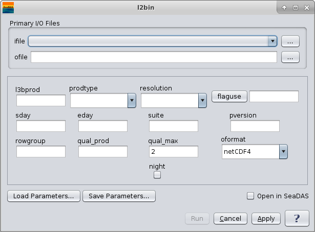
GUI Usage
Command Line Usage
GUI Usage
Arguments/Keywords
| UI Element Name |
Type |
Description |
Required/Optional |
Default Value |
| ifile |
ifile |
input filename/filelist |
Required |
|
| ofile |
ofile |
output bin filename |
Required |
|
| l3bprod |
string |
bin products
        Set to "ALL" or "all" for all L2 products in 1st input file.
        Use ':' or ',' or ' ' as delimiters.
        Use ';' or '=' to delineate minimum values.
|
Optional |
all products |
| prodtype |
string |
product type (Set to "regional" to bin all scans.) |
Optional |
day |
| resolution |
string |
bin resolution
        HH - 50m
        HQ - 100 m
        Q - 250m
        H  - 0.5km
        1  - 1.1km
        2  - 2.3km
        4  - 4.6km
        9  - 9.2km
        18 - 18.5km
        36 - 36km
        HD - 0.5 degree
        1D - 1 degree
|
Optional |
H |
| flaguse |
string |
flags masked |
Optional |
[see /SENSOR/l2bin_defaults.par] |
| sday |
int |
start datadate (YYYYDDD) [ignored for "regional" prodtype] |
Optional |
|
| eday |
int |
end datadate (YYYYDDD) [ignored for "regional" prodtype] |
Optional |
|
| suite |
string |
|
Optional |
|
| pversion |
string |
production version |
Optional |
unspecified |
| rowgroup |
int |
number of bin rows to process at once |
Optional |
-1 |
| qual_prod |
string |
quality product field name |
Optional |
|
| qual_max |
int |
maximum acceptable quality |
Optional |
2 |
| oformat |
string |
defines output format:
        hdf4:    output a HDF4 file
        netcdf4: output a netCDF4 file
| Optional |
netcdf4 |
| night |
boolean |
Check for SST night processing |
Optional |
false |
Actions/Buttons
| UI Element Name |
Type |
Description |
| Browser Button |
Button |
Selects ifile/ofile
|
| Load Parameters ... |
Button |
Reads in previously saved parameters and populates the fields in
GUI.
|
| Store Parameters ... |
Button |
Saves the current arguments in GUI in a file.
|
| Run |
Button |
Executes the l2bin command with arguments provided in the UI.
|
| Cancel |
Button |
Closes current processor GUI.
|
| Apply |
Button |
Makes current arguments effective.
|
| Open in SeaDAS |
Checkbox |
If selected, the ofile will be added to the open products list right after its generation.
|
| ? |
Button |
Displays the help content of the current command.
|
Command Line Usage
l2bin 7.0.3 (Nov 17 2022 15:35:40)
7.0.3
Usage: l2bin argument-list

  The argument-list is a set of keyword=value pairs. The arguments can
  be specified on the commandline, or put into a parameter file, or the
  two methods can be used together, with commandline over-riding.

  return value: 0=OK, 1=error, 110=north,south,east,west does not intersect
  file data.

The list of valid keywords follows:

   help (boolean) (alias=h) (default=false) = print usage information
   version (boolean) (default=false) = print the version
        information
   dump_options (boolean) (default=false) = print
        information about each option
   dump_options_paramfile (ofile) = print
        information about each option to paramfile
   dump_options_xmlfile (ofile) = print
        information about each option to XML file
   par (ifile) (alias=parfile) = input parameter file
   ifile (ifile) (alias=infile) = input L2 file name
   ofile (ofile) (default=output) = output file name
   fileuse (ofile) = write the filenames of the the input files used to this file
   suite (string) = suite for default parameters
   qual_prod (string) = quality product field name
   deflate (int) (default=5) = deflation level.  0=off or 1=low through 9=high
   verbose (boolean) (default=off) = Allow more verbose screen messages
   night (boolean) (default=off) = set to 1 for SST night processing
   qual_max (int) (default=2) = maximum acceptable quality
   rowgroup (int) (default=-1) = # of bin rows to process at once.
   sday (int) (default=1970001) = start datadate (YYYYDDD) [ignored for "regional" prodtype]
   eday (int) (default=2038018) = end datadate (YYYYDDD) [ignored for "regional" prodtype]
   latnorth (float) (default=90) = northern most latitude
   latsouth (float) (default=-90) = southern most latitude
   loneast (float) (default=0) = eastern most longitude
   lonwest (float) (default=0) = western most longitude
   minobs (int) (default=0) = required minimum number of observations
   delta_crossing_time (float) (default=0.0) = equator crossing time delta in minutes
         Caveat...if zero, the sensor default equator crossing time will be used
         This is not necessarily noon
   resolution (string) (alias=resolve) (default=H) = bin resolution
         H: 0.5km
         Q: 250m
        HQ: 100m
        HH: 50m
         1: 1.1km
         2: 2.3km
         4: 4.6km
         9: 9.2km
        18: 18.5km
        36: 36km
        1D: 1 degree
        HD: 0.5 degree
        QD: 0.25 degree
   prodtype (string) (default=day) = product type (Set to "regional" to bin all scans.)
   pversion (string) (default=unspecified) = production version
   composite_scheme (string) = composite scheme (min/max)
   composite_prod (string) = composite product fieldname
   flaguse (string) (default=ATMFAIL,LAND,HILT,HISATZEN,STRAYLIGHT,CLDICE,COCCOLITH,LOWLW,CHLFAIL,CHLWARN,NAVWARN,ABSAER,MAXAERITER,ATMWARN,HISOLZEN,NAVFAIL,FILTER) = flags masked [see /SENSOR/l2bin_defaults.par]
   l3bprod (string) (default=ALL) = l3bprod = bin products [default=all products]
    Set to "ALL" or "all" for all L2 products in 1st input file.
    Use ':' or ',' or ' ' as delimiters.
    Use ';' or '=' to delineate minimum values.

   area_weighting (int) (default=0) = Enable area weighting
        0: off
        1: pixel box
        2: pixel bounding box
        3: pixel polygon
   output_wavelengths (string) (default=ALL) = comma separated list of wavelengths for multi-wavelength products