geolocate_viirs
Creates a GEO file from VIIRS L1A input files.
Location
Details
Command Line Usage
Location
SeaDAS-OCSSW -> geolocate_viirs
Details
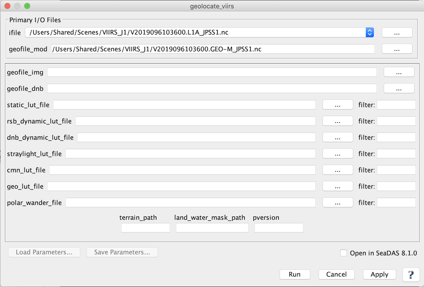
geolocate_viirs GUI
 |
Arguments/Keywords
| UI Element Name |
Type |
Description |
Required/Optional |
Default Value |
| ifile |
ifile |
VIIRS_L1A_file name |
Required |
|
| geofile_mod |
ofile |
GEOFILE Output filename |
Required |
Generated by the program based on the input L1A file name |
| geofile_img |
ofile |
Geolocation IMG filename |
Optional |
|
| geofile_dnb |
ofile |
Geolocation Day Night Band filename |
Optional |
|
| static_lut_file |
string |
static calibration LUT filename |
Optional |
|
| rsb_dynamic_lut_file |
string |
RSB dynamic calibration LUT filename |
Optional |
|
| dnb_dynamic_lut_file |
string |
day night band dynamic calibration LUT filename |
Optional |
|
| straylight_lut_file |
string |
stray light calibration LUT filename |
|
|
| cmn_lut_file |
string |
common calibration LUT filename |
Optional |
|
| geo_lut_file |
string |
geolocation LUT filename |
Optional |
|
| polar_wander_file |
string |
polar wander filename |
Optional |
$OCVARROOT/viirsn/polar_wander.h5 |
| terrain_path |
string |
path to the terrain height files directory |
Optional |
$OCDATAROOT/viirsn/dem |
| land_water_mask_path |
string |
path to the land/water mask file directory |
Optional |
|
| pversion |
string |
processing version string |
Optional |
Unspecified |
Actions/Buttons
| UI Element Name |
Type |
Description |
| Browser Button |
Button |
Selects ifile/ofile
|
| Run |
Button |
Executes the geolocate_viirs command with arguments provided in the UI.
|
| Cancel |
Button |
Closes current processor GUI.
|
| Apply |
Button |
Makes current arguments effective.
|
| Open in SeaDAS |
Checkbox |
If selected, the ofile will be added to the open products list right after its generation.
|
| ? |
Button |
Displays the help content of the current command.
|
Command Line Usage
geolocate_viirs 3.1 (May 31 2018 12:48:55)
Usage: geolocate_viirs argument-list

  This program takes a VIIRS L1A file and outputs geolocation files.

  The argument-list is a set of keyword=value pairs. The arguments can
  be specified on the commandline, or put into a parameter file, or the
  two methods can be used together, with commandline over-riding.

The list of valid keywords follows:

   help (boolean) (alias=h) (default=false) = print usage information
   version (boolean) (default=false) = print the version
        information
   dump_options (boolean) (default=false) = print
        information about each option
   dump_options_paramfile (ofile) = print
        information about each option to paramfile
   dump_options_xmlfile (ofile) = print
        information about each option to XML file
   par (ifile) = input parameter file
   ifile (ifile) = input L1A file name
   geofile_img (ofile) = Geolocation IMG filename
   geofile_mod (ofile) = Geolocation MOD filename
   geofile_dnb (ofile) = Geolocation Day Night Band filename
   static_lut_file (string) = static calibration LUT filename
   rsb_dynamic_lut_file (string) = RSB dynamic calibration LUT filename
   dnb_dynamic_lut_file (string) = day night band dynamic calibration LUT
        filename
   straylight_lut_file (string) = stray light calibration LUT filename
   cmn_lut_file (string) = common calibration LUT filename
   geo_lut_file (string) = geolocation LUT filename
   polar_wander_file (string) (default=$OCVARROOT/viirsn/polar_wander.h5) =
        polar wander filename
   leapsec_file (string) (default=$OCVARROOT/viirsn/IETTime.dat) = leap second
        file
   terrain_path (string) (default=$OCDATAROOT/viirsn/dem) = path to the terrain
        height files directory
   land_water_mask_path (string) = path to the land/water
        mask file directory
   verbose (boolean) (alias=v) (default=false) = turn on verbose output
   pversion (string) (default=Unspecified) = processing version string

This program can also accept a PCF file.  The PCF file option names take
precedence over the standard option parameters even if the standard option
is on the command line.  To over ride an option in a PCF file, use the PCF
option name on the command line.

use "-dump_options" on the command line to see a list of ALL option names.