| Geo-Coding Information | |
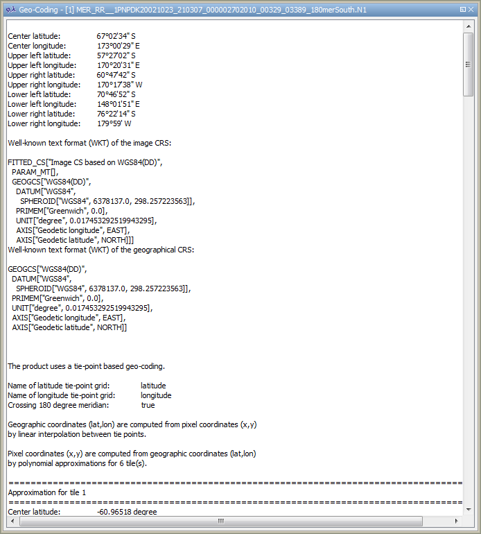
This dialog, opened via ![]() , shows the geo-coding information for the selected data
product. Geo-coding enables the Sentinel Toolbox to transform pixel co-odinates to geographical co-ordinates and vice versa.
Geo-coding can be either based on a map projection (product is geo-referenced) or based on tie point grids
(product is geo-coded). If a product is not geo-referenced, the Sentinel Toolbox uses the tie point grids "latitude" and
"longitude" for geo-coding.
, shows the geo-coding information for the selected data
product. Geo-coding enables the Sentinel Toolbox to transform pixel co-odinates to geographical co-ordinates and vice versa.
Geo-coding can be either based on a map projection (product is geo-referenced) or based on tie point grids
(product is geo-coded). If a product is not geo-referenced, the Sentinel Toolbox uses the tie point grids "latitude" and
"longitude" for geo-coding.
For tie point grid based geo-codings the transformation of a geographical co-ordinate to a pixel position is more complicated than the other way round. The Sentinel Toolbox uses either an iterative algorithm or a polynomial approximation depending on the root mean square error (RMSE) of the approximation. If the RMSE is underneath half a pixel, the approximation is used instead of the iteration because the latter can sometimes have no clear attraction point and would yield to infinite looping.
Note: A mouse right-click within the geo-coding information area brings up a context menu with the item Copy data to clipboard. This will copy the diagram data as tabulated text to the system clipboard. The copied text can then be pasted directly into a spreadsheet application (e.g. Microsoft® Excel).