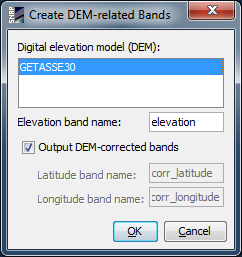
| Create DEM-related Bands | |
This command adds a new DEM-elevation band and optionally DEM-corrected latitude and longitude bands to the current product. The bands are computed by looking up each pixel in a selected high-resolution DEM (which is by default GETASSE30). As opposed to the orthorectification tool, which always reprojects the data product, the DEM-corrected latitudes and longitudes are computed in the selected product's current coordinate system.